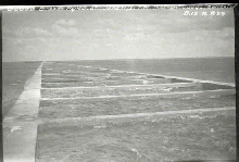
Water flowed through the Brooks Aqueduct every year from 1915 to 1979. This is an impressive statement, but the Aqueduct never measured up to its promise.
Crossing a two-mile (3.2 kilometre) valley, the water pulled through an inverted siphon under the CPR mainline, with a maximum elevation loss of less than 5 feet (1.5 metres) yielding a very low 0.01% gradient. The silting and plant growth in the flume, the backflow caused by struts which touched the surface of the water (and even fish!) decreased the velocity of the water. Most imply the design failed to calculate the friction of the water against the rough concrete. The Aqueduct was never able to deliver more than 2/3 of its anticipated 913 cfs (cubic feet per second) and that only after expensive alterations.
Eventually, the Eastern Irrigation District reduced its rated amount of irrigable land and thus lowered the demands on the aqueduct, but even these could not meet. This frustration prompted the CPR to keep water flowing in the colder months, virtually encouraging frost damage.
